

Investment Infomation
Why Invest?
A stable economy, safe environment, cost-effective labor force, and strong infrastructure.
The Gambia Investment & Export Promotion Agency (GIEPA) is the national agency established by an Act of Parliament in July 2010 responsible for the promotion and facilitation of private sector investments into The Gambia.
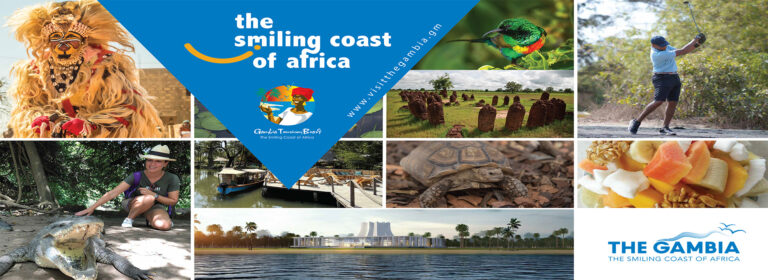
Tourism
Discover The Smiling Coast
of Africa
Why The Gambia?
- Biodiversity: The Gambia is a biodiversity hotspot. From birdwatching in the protected Tanji Bird Reserve to exploring Kiang West National Park, nature enthusiasts find their haven here.
- Community Involvement: Eco lodges allow travellers to immerse themselves in Gambian culture. You can participate in community projects, interact with locals, and contribute positively.
- Off the Beaten Track: These lodges offer a unique experience away from the tourist crowds. Imagine waking up to the sounds of nature and connecting with the real Gambia.
The Gambia Links and Websites
Personnel Management Office (PMO) – www.pmo.gov.gm
Office of the Public Service Commission (PSC) – www.psc.gov.gm
Gambia Tourism Authority (GTA) – www.gta.gm
Gambia Divestiture Agency (GDA) – www.gda.gm
Gambia Investment and Export Promotion Agency (GIEPA) – www.giepa.gm
Gambia Ports Authority (GPA) – www.gamport.gm www.gambiaports.com
Gambia Postal Services Corporation (GAMPOST) – www.gampost.gm
Gambia International Airlines (GIA) – www.gia.gm
Gambia Telecommunications Company Ltd.(GAMTEL) – www.gamtel.gm
Gambia National Olympic Committee (GNOC) – www.gnoc.gm
Gambia Civil Aviation Authority (GCAA) – www.gcaa.gm
Gambia Bureau of Statistics (GBOS) – www.gbos.gm
National Planning Commission (NPC) – www.npc.gov.gm
National Environment Agency (NEA) – www.nea.gm
National Assembly Services Authority – www.nationalassembly.gm
National Training Authority (NTA) – www.nta.gm
National Centre for Arts and Culture (NCAC) – www.ncac.gm
National Nutrition Agency (NaNA) – www.nana.gm
Central Bank of the Gambia www.cbg.gm
Public Utilities Regulatory Authority (PURA) – www.pura.gm
Independent Electoral Commission (IEC) – www.iec.gm
Social Security & Housing Finance Corporation (SSHFC) – www.sshfc.gm
Other Government Websites
Royal Victoria Teaching Hospital (RVTH) – www.rvth.org
University of the Gambia (UTG) – www.unigambia.gm
Gambia College – www.gambiacollege.gm
Gambia Biometric Identification System (GAMBIS) – www.gambis.gm
Precolonial history
This discussion focuses on The Gambia since the late 15th century. For a treatment of earlier periods and of the country in its regional context, see western Africa, history of.
Gambian history before the arrival of Europeans has been preserved to some degree in oral traditions. Its history is closely tied to that of neighboring Senegal, since it was only in the late 19th century that a distinction was made between Senegal and The Gambia; until that time the region is often referred to as Senegambia.
The Malinke and Wolof kingdoms, fully established by the 19th century, were still in the formative stages when the Venetian explorer Alvise Ca’ da Mosto (Cadamosto)—in the service of Portugal’s Prince Henry the Navigator—arrived in 1455. The Malinke were the westernmost peoples of the old Mali empire. The Wolof probably migrated from the Songhai regions, and the Fulani pastoralists were part of a migration from the Futa Toro. Although locally powerful, none of the small Gambian kingdoms were ever strong enough to dominate Senegambia. Continuing internecine warfare made it easy for the French and British to dominate the territory.
European colonization
The first Europeans in the Gambia River regions, the Portuguese, established trading stations in the late 1400s but abandoned them within a century. Trade possibilities in the next two centuries drew English, French, Dutch, Swedish, and Courlander trading companies to western Africa.
A struggle ensued throughout the 18th century for prestige in Senegambia between France and England, although trade was minimal, and no chartered company made a profit. This changed in 1816 when Capt. Alexander Grant was sent to the region to reestablish a base from which the British navy could control the slave trade. He purchased Banjul Island (St. Mary’s) from the king of Kombo, built barracks, laid out a town, and set up an artillery battery to control access to the river. The town, Bathurst (now Banjul), grew rapidly with the arrival of traders and workers from Gorée and upriver. The Gambia was administered as a part of British West Africa from 1821 to 1843. It was a separate colony with its own governor until 1866, when control was returned to the governor-general at Freetown, Sierra Leone, as it would remain until 1889.
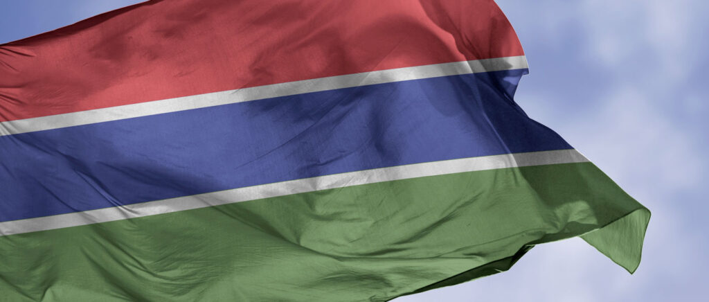
The Republic of The Gambia
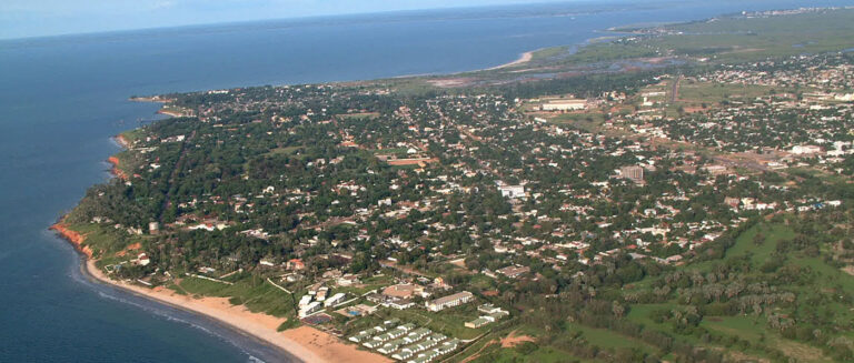
The Gambia, country in western Africa situated on the Atlantic coast and surrounded by the neighboring country of Senegal. It occupies a long narrow strip of land that surrounds the Gambia River. The land is flat and is dominated by the river, which is navigable throughout the length of the country.
The peculiar shape and size of the country are the result of territorial compromises made during the 19th century by Great Britain, which controlled the lower Gambia River, and France, which ruled the neighboring colony of Senegal. Periodic talks in the 20th century to unite The Gambia and Senegal led to the short-lived Senegambia confederation (1982–89).
The Gambia is Africa’s smallest non island country. It is also one of Africa’s most densely populated countries. A few towns are located upriver, but most Gambians live in rural villages. The major ethnic groups are similar to those in Senegal and consist of the majority Malinke and also include Wolof, Fulani (Fulbe), Diola (Jola), and Soninke peoples. The Gambian economy is heavily dependent on peanut (groundnut) production and export.
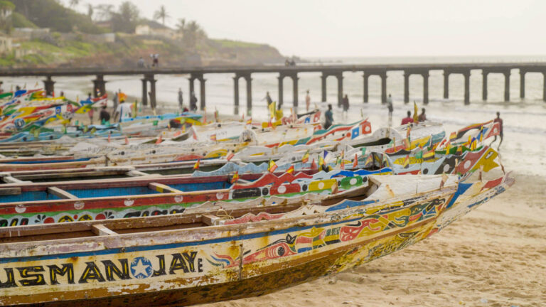
The country is known for the beaches along its small Atlantic coastline and for being home to Jufureh (Juffure), the reputed ancestral village of Kunta Kinte, the main character in Alex Haley’s well-known novel Roots. The capital, Banjul (called Bathurst until 1973), is situated where the Gambia River flows into the Atlantic Ocean.
The Gambia is a strip of land 15 to 30 miles (25 to 50 km) wide on either side of the Gambia River and extends almost 300 miles (480 km) into the interior; except for a short coastline along the Atlantic Ocean, it is entirely surrounded by Senegal.
Population
The current population of Gambia is 2,812,152 as of Wednesday, May 7, 2025 based on Worldometer’s elaboration of the latest United Nations data1.
Gambia 2025 population is estimated at 2,822,093 people at mid-year.
Gambia population is equivalent to 0.034% of the total world population.
Gambia ranks number 143 in the list of countries (and dependencies) by population.
The population density in Gambia is 279 per Km² (722 people per mi²).
The total land area is 10,120 Km² (3,907 sq. miles).
61.34% of the population is urban (1,731,095 people in 2025)
The median age in Gambia is 18.6 years.
Relief and drainage
The Gambia River is the country’s dominant feature. It flows across a plateau of Miocene-Pliocene sandstone consisting of compacted sediment composed predominantly of quartz grains formed from about 23.7 to 1.6 million years ago. In the east, narrow valleys are separated by broad interfluves or flattish hills. In the west, lower and smaller sand hills alternate with depressions filled in with sand to form a flat plain.
Soils and climate
The Gambia has a wet-and-dry tropical climate characterized by an intense rainy season occurring generally between June and October and by a longer dry season. Near the coast the rainy season lasts longer, and the rainfall is heavier, diminishing eastward. At Yundum the average annual rainfall is about 50 inches (1,300 mm), and the mean monthly temperature tends to be in the upper 70s F (mid-20s C), while at Basse Santa Su, about 270 miles (435 km) inland, the comparable figures are about 40 inches (1,000 mm) and the low 80s F (upper 20s C). The relative humidity is high but drops from December to April, when the dry northeastern wind known as the harmattan is dominant.
Plant and animal life
The vegetation cover of The Gambia is savanna on the uplands, various kinds of inland swamp in the low-lying areas, and mangrove swamp along the brackish lower Gambia River. Few wild animals are native to the region, and those that survive are under pressure from the human and domestic animal populations. In the middle and upper river areas there are warthogs, monkeys, baboons, antelope, pygmy hippopotamuses, and crocodiles. In addition, more than 500 species of birds live throughout the country. Birds and wildlife can be found in Bijilo Forest Park, along the Atlantic coast, the Abuko Nature Reserve, just upriver from Banjul, Kiang West National Park, farther inland, and River Gambia National Park (also known as Baboon Island National Park), near Kuntaur.
People Ethnic groups
The river basin was a focal point for migrating groups of people escaping the turmoil of western Sudanic wars dating from the 12th century. The Diola (Jola) are the people longest resident in the country; they are now located mostly in western Gambia. The largest group is the Malinke, comprising about one-third of the population. The Wolof, who are the dominant group in Senegal, also predominate in Banjul. The Fulani settled the extreme upriver areas, and their kingdom, Fuladu, became a major power in the late 19th century. The Soninke, an admixture of Malinke and Fulani, are also concentrated in the upriver areas.
Languages
English is the official language, but the most frequently spoken languages are generally of the Atlantic branch of the Niger-Congo family. Mandinka and Wolof constitute the lingua francais of the country, and other languages spoken include Pulaar (Fulbe), Serer, Diola, and Soninke. Some Muslim clerics are literate in Arabic.
Religion
The population is overwhelmingly Muslim. There are a small number of Christians—predominantly Roman Catholic—and some adherents of traditional beliefs.